 FREE UK tracked delivery
 Order by 12pm Mon-Fri for same day dispatch
December 2021 - Landscape, ecology & navigation clues
by Nigel Williams
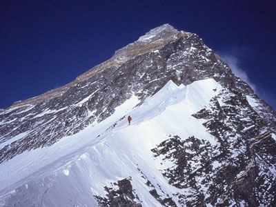
I have often felt in awe when high on Scottish west coast mountains with a view of the sea, and the weather, whatever it is, adding to the atmosphere. Natures three most powerful elements thrown together.
As we learn to read the terrain and interpret the map, particularly contours, we may find that they start to inform each other. Learning the basics of geomorphology and glaciology enhances our ability to interpret the map. U-shaped glacial valleys, the escarpments of limestone areas, or the volcanic remains in areas of Fife and East Lothian.
The contours illustrate them all and familiarity with that type of terrain enables us to better envisage the area from the map. Harvey maps further help with the addition of geological maps on the back of their British Mountain map series.
We can also therefore anticipate the likely underfoot conditions, the flora and fauna to expect. Many things also correlate to altitude, trees grow higher up south facing slopes than north facing slopes, Grouse tend to be below 900m, Ptarmigan above 900m. Quite a few mosses and lichens also come and go around that altitude in the UK. In the Alps at around 2000m one can find quite similar vegetation to the UK mountain flora such as heathers, Juniper, Blaeberry commonly found here around 300 - 900m.
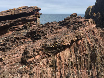
It is famous in the history of geology known as "Hutton's Unconformity" and confirmed other theories he was developing from other rock irregularities he had observed in Glen Tilt, Jedburgh and Arthur's Seat. This was the beginning of the suggestion that the earth could not be the biblical estimate of 4000 years old. Around 160 years later it would lead to the science of plate tectonics.
Interestingly, Charles Hutton (no relation) created the first terrestrial contours in 1776 as a result of studies on Schiehallion to work out the mass of the earth. This gave map makers the ability to document the result of tectonic plate movement which is further sculped by glaciation, rivers and weather.
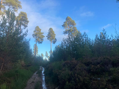
From big picture stuff to the small occasionally useful. I was running a navigation course in the Lomond hills on Fife in an area which at the time I was unfamiliar with. We were following a path at night and had estimated about 20 minutes over the brow of a hill to a fir forest plantation just over 1km away. However, we arrived at the forest edge after about 10 minutes.
Somewhat baffled and with little other useful information to see someone suggested counting the layers of branches up the trunk as each layer is a year of growth. There were 8 layers and then checking the print date on the map it was over 10 years previously. 10 minutes further on the trees suddenly tripled in size.
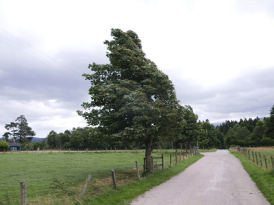
If a track with ruts and puddles down either side is running in an east west direction it is common for the north edge of the track to be drier than the south edge because it gets the light of the sun. The south edge is often in the shade of undergrowth on the edge of the track and it takes longer to evaporate the water. There appears to be evidence that dogs like to orientate north /south when toileting (hence the turning around a few times before doing their business) and like many creatures, appear to be able to detect the earths' magnetic fields.
All these observations enhance my appreciation of the cartographers work and how lucky we are in the UK to have some of the finest map makers and maps available anywhere in the world which enrich our enjoyment of the landscape.
HARVEY British Mountain Maps, made in conjunction with the British Mountaineering Council (BMC), are a great aid to confident and sure navigation. Click to browse the full series.
Return to the Navigation Blog


