 FREE UK tracked delivery
 Order by 12pm Mon-Fri for same day dispatch
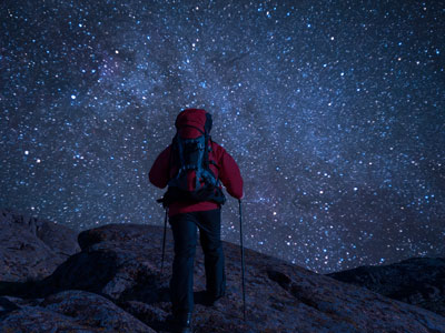
Journey Stories and navigation methods
by Nigel Williams
Static activity in the same place in the outdoors, such as a forest school, does not have quite the same impact, but it does engage youngsters with their surroundings and helps them to be more observant and terrain confident as they become used to being in a different environment.
Historically the sun and stars, wave patterns at sea and other elements of the natural world, have acted as landmarks, and maps were carried in our heads as stories and descriptions.
Journey Sticks
This simple idea has been used by indigenous people all over the world to help them remember a journey or tell a story of their travels. It acts as a sort of portable map, long before humans could draw a map on something easily portable that they could use as a navigation aid (unlike a cave painting).
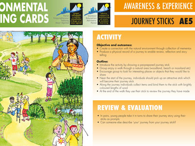
All that is needed is a stick to which one can attach things found along the path to help us remember the journey. Natural substances such as tree sap might have been used as a glue in ancient times. But today string or elastic bands wrapped around the stick enables things like leaves, flowers berries, fir cones, feathers etc to be attached in an order along the stick. We could also include bits of paper with additional information drawn or written on as well.
Once the walk is over the participants can recount their journey or can be asked to draw a map using their stick to help them recall it.
Skyline Carvings
I am sure most of us can instantly recognise well-known skylines in a photo. Another type of map used by the Inuit were skyline carvings, usually made from antler or bone, but occasionally wood. It is a 3D carving of the hills (usually the coast line for when they are out hunting in kayaks) from a certain point which is held up to match the distant skyline. It is then possible to estimate ones' position in both distance and left or right of the position the carving was made from. When kayaking at sea in the mist the Inuit were also able to differentiate bird calls distinctive only to their village, despite the same bird species being widely distributed up and down the coast.
Measuring distance on land was always done by pacing, there are written records of that going back to pre-Roman times, but it will almost certainly have been used for many thousands of years before that. People like Alexander the Great around 330BC had troops known as Bematists who were trained to pace accurately in order to make accurate maps of his empire. Surprisingly, the British military in India from the middle of the 1800s up to 1896 were still using pacing to help make accurate maps of the Himalayas. They trained local spies who became known as the "Pundits" to undertake dangerous mapping journeys into Nepal and Tibet.
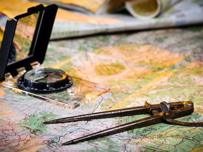
Around the early 1900s the creation of the paper map made maps more available for recreational purposes, this combined with a simple hand-held compass, completely changed the methods of human navigation and enabled a numeracy based method of communicating navigational information with much greater accuracy.
Maps do tell us stories and are a wonderful record of history, but perhaps the storytelling of a journey is becoming a forgotten art; more often than not these days we simply communicate navigational information with a postcode or 3 words and let a device work it out for us. And when we reach the destination we are unable to describe how we got there.
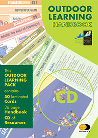
Journey Sticks is an exercise/activity card that is part of the wider a Outdoor Learning Cards Pack, aimed at educating and developing young people using outdoor learning methods.
Return to the Navigation Blog


