FREE UK tracked delivery
 Order by 12pm Mon-Fri for same day dispatch
Navigation on skis
by Nigel Williams
As a Nordic ski addict of some 45 years, I have to point out that cross-country skis have been around for an estimated 4000 years whilst downhill skiing derived from that only around 130 years ago, as materials and tools enabled the development of more robust boots, bindings and skis that enabled turning. The first snow boards appeared around 60 years ago.
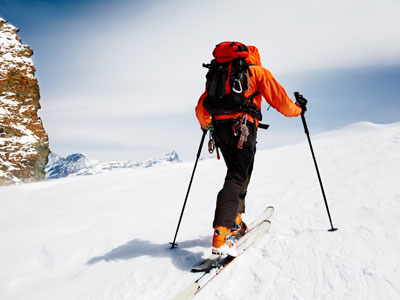
Journeying on skis (cross-country, ski mountaineering or splitboard/snowboard) in the hills and mountains of UK requires the same level of winter pre-planning, using weather and avalanche forecasts, as for winter walking/mountaineering. Similarly, on the hill, the "Be Avalanche Aware" observation and navigation skills and strategies are required.
To be realistic though ski touring is really a fair weather, good visibility activity, unless one knows the area well or there are minimal potential hazards. Close engagement with the map and compass can also be inhibited by the need for ski poles. GPS and digital mapping has significantly changed this activity, enabling largely hassle-free skiing, with much of the navigation requiring just quick location checks.

A skier sliding downhill, even on a very gentle slope, in whiteout may make that decision too late. A wise course of action, on occasion, is to take the skis off and walk, so crampons and an ice axe may be necessary in Munro terrain. Many ski tourers now carry an avalanche transceiver (another item to keep away from your compass), shovel and probe.
At the planning stage the descent is probably the most important part of the journey, and it can be estimated from the distance between the contour lines. Skiing off-piste there are many variables in determining people's comfort zone when it comes to steepness. Red ski runs are around 15 degrees/25% gradient, and that is enough for many people. Around 30° or 57.5% gradient is the most common avalanche angle, but the risk also depends on temperature, altitude and aspect. 30° is also the angle at which OS maps starts to miss out intermediate contour lines.
Most phones have an angle measurement on them. Click here for more information on estimating slope angles.
Using the GPS and digital mapping is, of course, a good easy option, but competence and confidence with map and compass skills are essential as a backup. It is very difficult to measure the distance descended, so before GPS linked digital mapping became available the altimeter was the essential item for ski touring.
Going uphill and along the flat, navigation is essentially the same as winter walking. Skiers zigzag in ascent more than walkers, so it can be easy to lose a sense of height gain. The biggest challenge to tracking one's progress is going downhill in poor visibility.

For maintaining direction on the move, attach a loop of elastic to the compass, knotted in the middle to make a figure of 8 shape. Put both loops around the wrist, with one over the front and back of the base plate, so the compass is level when holding a ski pole naturally. It is possible to maintain a direction whilst still using the pole to some degree. For prolonged expedition navigation a "compass board" can be helpful. Basically, this is a frame that hangs around the neck and is secured at the waist, which will support a compass or GPS. This enables a full slide and glide ski action.
In fine weather on plateau terrain, using our shadow is an easy way to maintain a rough direction, knowing that this slowly changes throughout the day.

Without the trail as a guide, traversing a slope to a safe fall line descent in poor visibility (to avoid a small outcrop or steeper area of the slope perhaps) involves being able to make an accurate assessment of the slope aspect (the direction it is facing) or using the GPS for a pinpoint location.
Another poor visibility scenario might be partial descent of a slope prior to making a traverse above a hazard, or to go through a small col before descending again. The altimeter can be very useful, allowing one to ski a descent naturally and to stop at a specific height before the traverse. Some altimeters have a height alarm which can be set for the height the skier needs to start the traverse.
All these strategies also work for winter walking, so whether you are a skier or walker the strategies are transferable.
Return to the Navigation Blog