 FREE UK tracked delivery
 Order by 12pm Mon-Fri for same day dispatch
Stuck in Greenland
by Nigel Williams
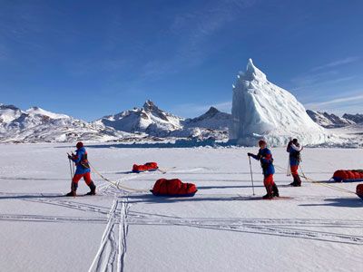
The Tasiilaq area, on the large island of Ammassalik, is a stunning range of mountains, glaciers, ice caps and valleys. The area has been popular with mountaineers for quite a few decades; the Army Mountaineering Association had a summer expedition here in 1964. I have been visiting since 2008 on summer and winter trips.
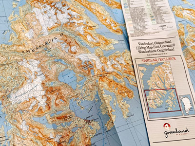
In 1981 HARVEY Maps was involved with the air photography and photogrammetry, working with the Danish mapping company Compukort to produce a series of Greenland maps. The Tasiilaq map is one of the series and is available through HARVEY maps.
It is an interesting map, and has had a few updates, but these maps are more about GPS compatibility and magnetic variation rather than landscape changes linked to climate change.
The scale is 1:100,000 and the contour interval is 25m. Looking at the current satellite imagery is interesting; quite a few of the small glaciers and icecaps have either disappeared, receded or become a series of smaller ice fields.
This, of course, is not just an issue confined to Greenland. Across the world existing mapping needs constant updating. At the same time as adventure tourism increases, so does the carbon footprint of such adventures. Research suggests the global adventure tourism market size reached US$ 1,036 Billion in 2022. Looking forward, it is expected to reach US$ 3,001 Billion by 2028, exhibiting an annual growth rate of around 20% during 2023-2028.
Educating young people with first hand experiences on the ground is one of many ways of spreading an understanding of the impact of climate change.
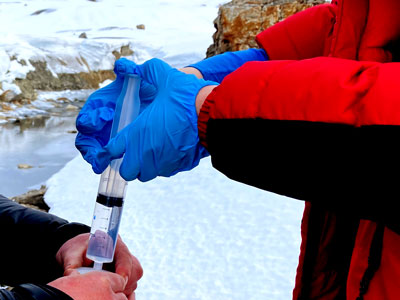
The Polar Academy also runs a cultural exchange, with 5 Greenlandic teenagers coming to Scotland for a few weeks in the summer, and some Polar Academy teenagers who were not involved in the winter expedition visiting in the summer and carrying out further data collection.
The reason that we are stuck in Greenland is the weather. The movie Groundhog Day is starting to resonate. Remarkably though, Tasiilaq has just experienced the coldest and driest winter for 20 years, with very little snow fall. The sea ice has extended way beyond anything I have seen before, but in the last week it has been raining for 4 days, with temperatures above zero. What little there is in the way of roads in the town have become rivers, and apparently the airport runway is flooded and the snow ploughs useless
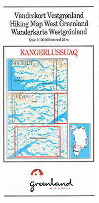
- If you are planning a trip to Greenland then you probably need a map! Take a look at the range of maps we stock and make sure you go prepared.
Return to the Navigation Blog


