 FREE UK tracked delivery
 Order by 12pm Mon-Fri for same day dispatch
The Munros and other tick lists
by Nigel Williams
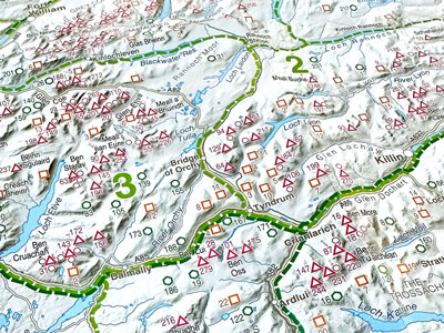
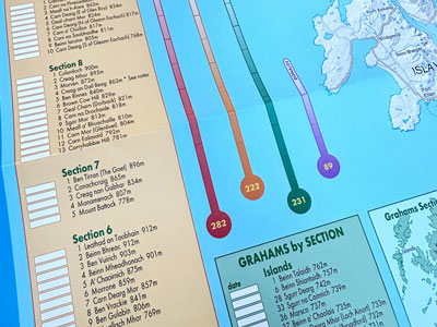
For those wanting to bag Munros, the HARVEY cartographers have mapped all 282 Munros - Scottish peaks over 914.4m (3000ft) and the additional 227 Munro tops (peaks over 3000ft, usually a subsidiary of a main peak but not given Munro status) the maps also cover most of the 222 Corbetts and 231 Grahams. Munros are a well-known list, but Corbetts and Grahams are less well-known.
There are 231 Grahams which are defined as Scottish peaks over 2,000ft (610m) but less than 2500ft (762m) and there has to be a drop of at least 150m between it and any other adjacent hill. Note that the height drop is not given in feet probably because the list was created in 1992 when most maps had gone metric. The Grahams came about through a collaboration between Fiona Torbet (née Graham) and Alan Dawson who were both making similar lists.
One of the problems of using an OS map for a day out collecting multiple Munros is that one can end up climbing a particular hill thinking it is a Munro, when in fact it isn't. Or decide to contour round a smaller hill only to find when you get home that it was in fact a Corbett and you would have gone over it if you had known.
HARVEY Maps helps the dedicated Scottish mountain or hill bagger distinguish between Munros, Corbetts and Grahams by colouring the names of the peaks on their maps according to the list they are in. Bold red for a Munro, Orange for a Corbett and Green for a Graham. The coloured names jump out of the sheet and leave no uncertainty as to the status of a particular mountain or hill. You can see them in the HARVEY book of maps The Munros: The Complete Collection of Maps it is a unique and stunning cartographic record with around 150 pages of maps of the Highlands of Scotland.
There are quite a few other lists such as the Donalds - 89 hills over 2,000 feet (610m) in the Scottish lowlands, in England there are Wainwrights in the Lakes, in Wales, the Welsh 3000ers etc. For the GPS geeks looking for a tick list, allegedly (I have not attempted it) a popular one is to visit the 6 figure grid reference that matches your date of birth in every National Grid 100kmsq area denoted by the 2 letter prefix, 30 - 50 or so depending on whether you want to keep your feet dry or are a sea kayaker or sailor.
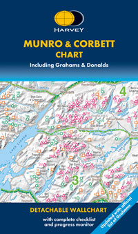
The Munro & Corbett Wallchart, by HARVEY Maps, is the perfect way to track the mountains that you have climbed. Featuring tick lists for Munros, Corbetts, Grahams and Donalds, it is the perfect map to get you started.
Return to the Navigation Blog


