 FREE UK tracked delivery
 Order by 12pm Mon-Fri for same day dispatch
Navigation confidence for beginners
by Nigel Williams
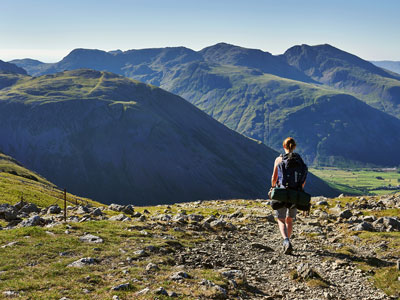
Over many years of questioning people who attend navigation courses, a majority will say they are there to improve their confidence with navigation skills. Often it is on the back of a recent experience of becoming disorientated and perhaps having been over reliant on another person's navigation, so it is often about becoming an independent navigator. Some of these people have extensive hill walking experience yet to get to grips with basic independent navigation and build confidence it would be wise to develop the skills in less serious and remote terrain.
At this point I have to state the obvious, we are unlikely to be confident of something we do not practice. Having said that we need to learn the skills in order to practice them. Skills are best learnt as a series of progressions and turning theory into practice before moving to the next stage. Navigation involves observation, interpretation and decision making and from time to time we all get it wrong. Being able to navigate successfully and resolve any errors is very much simpler if we keep to tracks and paths. Every aspect of navigation increases exponentially as soon as we leave the path.
Traditionally, the teaching of navigation skills has been based around map reading and advanced compass skills but these do not usually align to our levels of terrain confidence and natural human wayfinding progressions. Broadly speaking our navigation skills are developed in stages linked to the terrain we feel confident in and as our spatial awareness develops.
Planning is the first step to building confidence - it helps reduce surprises.
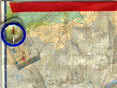
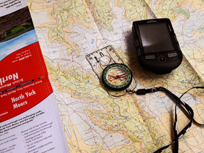
1. Don't be "Sedated by Software". Use a paper map and keep it to hand and folded so you can glance at it and follow your progress without stressing about battery life.
3. We all walk at different speeds so it is an important part of planning to estimate time and distance. A simple rule of thumb is that on all standard maps, one grid square is 1km and it is likely to take 15-20 minutes to cover that square. Diagonally it is 1.5km and likely to take 25-30 minutes. Plan conservatively, 15 minutes across a square is 4kph, 20 minutes is 3kph to allow for stops, etc. If much of the route is uphill add 1 minute to the timing for every contour crossed. Downhill is treated the same as being on the flat. Another useful skill is to know how many paces you take to cover 100m. A pace is 2 steps so chose a foot and only count every time that foot hits the ground - for 100m it will be around 65 paces. It works quite well for a few hundred metres.
There are 3 simple skills a novice needs to practice.
1. When observing your surroundings, be curious about landmarks, paths, fences, streams, woodlands, and whether you are going up or down and check against what you see on the map. Anticipate what you might see next, and as you walk along mentally tick off the features you pass which enables you to track your progress. If you miss a junction and things start to not make sense you will be alerted quickly and have less far to back track. Do not try to go cross country.
3. Practice some timing and pacing of the distance on the map and on the ground in relation to your plan. Ticking off the features you pass is the key to this.
Practice is key to confidence, don't rely on others, have your own map and compass and check the person who might assume the role of navigator. We all make navigational errors and so it provides a back up as well as a second pair of eyes and a brain.
In a 2024 a paper published in the journal of Environmental Psychology reviewed 23 research papers on the detrimental impact of habitual use of GPS and phone mapping. It concluded "the more individuals rely on GPS to reach destinations the more poorly they perceive their navigation skills and the poorer is their knowledge of the environment". This is an issue of confidence - furthermore, whilst following the blue dot on the screen we fail to observe and relate the terrain and the map, the process by which we develop our cognitive navigation functions of spatial awareness and map memory. Nor do we practice the decision making elements.
Mountain Rescue teams exist to deal with serious emergencies in the hills, calling them when lost should be a last resort. They are tasked by the police so in the first place that is who to call using 999 or 112. They can often locate your position from the nearest phone masts and can help by giving directions over the phone as they know their area intimately. Even if your mobile provider indicates there is no service where you are if you dial 999 it automatically links you into all the providers. You can also set up your phone to use a text from emergency help. Register your phone number with emergencysms.org.uk and consider keeping one phone in your group for emergencies.
There is a lot more information available on this subject. Take a look at Mountain Rescue's safety page and also Adventure Smart.
- If you are in need of a compass then we stock a great range of items and other useful navigation equipment, suitable for all levels of navigation.
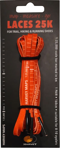
- For the perfect lanyard to go with your compass, the HARVEY Map - Measure - Go! scale bar laces double up to make measuring distance easy! Available in two scales, 1:25,000 scale markings (red) and 1:40,000 scale markings (yellow).
Return to the Navigation Blog


