FREE UK tracked delivery
 Order by 12pm Mon-Fri for same day dispatch
December 2021 - Survey Diaries, the Cheviot Hills
Day 1: Double rainbows and Double Deckers
The weather forecast wasn't inspiring, with rain due every hour, but I was all set for a day on the hills. My map board, where I note down the map updates and amendments, was printed on waterproof paper, which was then protected by a sheet of clear film. If things got even worse I had a waterproof carry case as a third layer of protection. Both wrapped in many layers, the map and I were ready to take on the Cheviot Hills.
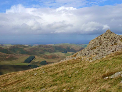
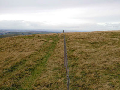
Today's route covered 20km of unchecked paths in and around College Valley in the northern Cheviot Hills. I set off in the rain along College Burn in search of a suspected path connecting Hethpool and Southernknowe . After a good morning's walking I appeared in Southernknowe with the path correctly plotted, features updated, and significantly wetter than when I started. The clouds began getting lighter for the next stage of the survey. I was due to loop round to the east along the ridge of the valley and back to the starting point. As the elevation picked up, so did the wind. The higher I got, the more the Cheviots unfurled in front of me. The views were spectacular! New paths and boundaries were noted as I made my way along each of the cairns along the shelter.
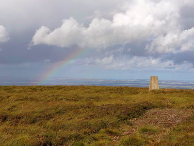
Image 002
The remainder of the route took me down to calmer elevations and hooked through farmland back to the starting point along the St Cuthbert's Way. It was a productive day; many kilometres of new paths were established as well as new map updates, but it was certainly time to get back into the warm and dry.
Day 2: New paths and new friends
In complete contrast to the previous day, the weather was kind in the morning. I set out on my 21km route from Kirk Yetholm in Scotland, which saw me straddling the England/Scotland border before contouring round to the east around The Cheviot.
Fortunately, I managed to negotiate the bog quickly enough to reach the mountain refuge hut on Auchope Rigg before the heavens opened. Here I crossed paths with Dave from Liverpool, who had the same idea - to wait for the rain to pass within these four wooden walls. Dave produced a double decker out of his rucksack. It must be popular with hillwalkers. My daily double decker was already long gone, but knowing that a big climb up towards The Cheviot was imminent I refuelled and headed back out to finish the day's walking in the passing showers.
Day 3: Border crossings and border collies
The final day was shaping up to be a cracker. Another early rise was forgiven by the clear blue skies at my starting point of Hethpool, England. A welcome change to the two soggy days that preceded it. 18 sunny kilometres along St Cuthbert's Way to Morebattle, Scotland lay ahead of me. Spirts were high due to a mixture of good weather, the final day push and the discovery of free beer for St Cuthbert's Way walkers in Morebattle's pub.
In contrast to the previous two days I was coming across many hikers right from the start; a testament to how popular the St Cuthbert's Way route is. It was clear that my annotations and discoveries today would be of benefit to many future walkers on the route, as well as other Cheviot ramblers.
"This isn't bloody woodland!" one lady exclaimed to me as she looked at her (non-HARVEY) map, and then around at the clear absence of any trees. I was then very happy to tell my new friend about the purpose of my trip, and that this change had been noted on my big map board.
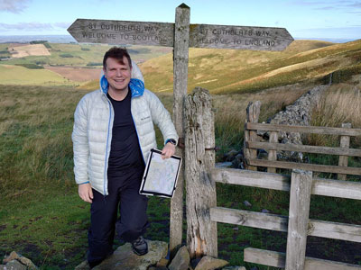
As I descended my last English hill, Scotland was in sight. In a couple of hundred metres there would be the novelty of walking into Scotland from England whilst travelling in a southerly direction - one for my fellow geography nerds. At the border I bumped into Cathy and Susan who were not as excited at the prospect of crossing a border in its non-intuitive cardinal direction, but nonetheless excited that they were crossing it. A significant milestone along their St Cuthbert's journey. We took pictures by the signpost at the border and wished each other well for the remainder of our journeys.
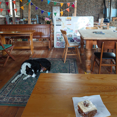
A few map annotations later and I had indeed arrived in Morebattle. My first port of call was the St Cuthbert's Coffee Shop where I was greeted warmly by an old Border Collie (judging by TripAdvisor this greeting does not make me special, this is part of the hospitality). As I enjoyed my carrot cake with my new four legged friend, I reflected on how much the team had covered, 180km all over the Cheviot Hills in 3 days, picking up plenty of updates and annotations that would not have been spotted without a ground check.
The Cheviot Hills are a lovely part of the country, and it was a pleasure to map them. I fully recommend a visit to this area (with the newly updated HARVEY Map of course!) And if you do visit, say hello to my (and now your) furry friend in Morebattle for me.
Now it's time to for that free beer.
Take a look at the newly updated Cheviot Hills Superwalker XT 1:25,000 map, and why not view the slideshow for a closer look at how we make our maps.
Return to the News & Features Blog