 FREE UK tracked delivery
 Order by 12pm Mon-Fri for same day dispatch
How HARVEY maps are made - Cartography & Survey
Cartographic editing
The photogrammetry stage involves recording all the features of the landscape ready to visually turn this into the map you have come to recognise. The raw data captured by the photogrammetrist needs to be organised. Sense and order has to be made of all the complicated lines that have been plotted. This is done by applying a map specification to each layer: the particulars of the line thickness, colour and pattern of every feature.
Contours form the basis of the map and provide the user with an accurate impression of the terrain. Major crags and other rock information are clearly pulled out from the raw data. One special feature of the HARVEY map is clarity and detail. This is important to us and our users. To avoid cluttering and obscuring the picture of the ground with too many rock symbols, we change the contour colour from brown to grey where the ground is predominantly rocky (made up of smaller crags, slabs and other bare rock).
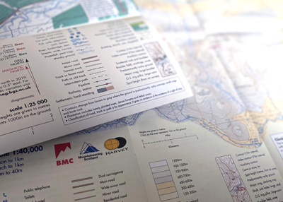
In addition to the photogrammetric data, the cartographers add place names to the map, along with other useful information such as public rights of way and tourist facilities. The cartography continues with map layout design. Surround information, including the legend (key to map symbols), National Grid, access, safety information, how to give a grid reference, scale bar and north arrow all have to be carefully designed into the final map layout without obstructing any map data. Finally, a cover is designed, and an inspiring cover photograph selected. This ensures that every HARVEY map is unique.
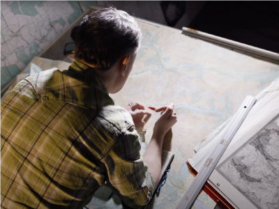
At HARVEY Maps we go out and physically check our maps are accurate. Paths and tracks are walked, boundaries are checked and rights of way are updated. Field-checking our base map is a crucial stage in making one of our maps. The base map produced by the photogrammetry contains all the physical detail, but changes that have occurred since the photos were taken must be identified and included in the final map.
We map some of the most beautiful places in the UK and some of the finest areas for hill walking and climbing. The survey team often spends several days in the field and often must cover 25km each day on foot, whatever the weather, covering the area of the sheet and checking that what is on the ground is shown on the map. Farmers put up fences; walkers build (or demolish!) cairns; footbridges are washed away in floods, or repaired and replaced; foresters fell trees, plant new ones and make new forest roads: these are the type of things our surveyors are on the lookout for.
Once the field checking stage is complete, the base map is edited and updated with survey changes. The map then goes through many proof prints where everything is checked and double checked (sometimes triple checked!) before the final digital files are sent to the printer. We use specialist map printers who have the skills and technology to allow the maps to be printed on waterproof polyethylene material.
The finished product
HARVEY has been making high quality maps for outdoor recreation since 1977 and has coverage of the popular walking areas of the UK and Ireland.
Have fun with your HARVEY map! It is a work of art, as well as a technical piece of safety equipment. We enjoyed creating it. We're sure you'll enjoy using it.
Superwalker maps - 1:25,000
British Mountain Map - 1:40,000
Ultramap - 1:40,000
Trail Maps - 1:40,00
Return to the News & Features Blog


