 FREE UK tracked delivery
 Order by 12pm Mon-Fri for same day dispatch
How HARVEY maps are made - Photogrammetry
How do we make our maps? Where does our data come from? Our maps are crafted at our HQ in Doune, Scotland, by our highly skilled team of photogrammetrist's and cartographers. Pete, our senior photogrammetrist, takes us through the process of map making at HARVEY Maps in the first of two blogs.
Introduction
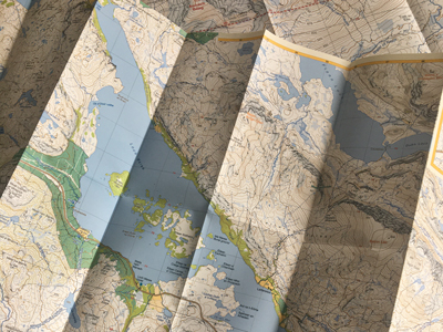
Choosing an area to map is the first step. There are lots of areas in the UK and Ireland that we have still to map so the team must research and agree on an area for the next new map. They need to decide on the map format and whether it's a sheet map containing lots of exciting hills, or a long distance path map like the South West Coast Path.
Once the relevant data has been captured it is sent to our cartographers who then make sense of all the lines, add text and additional information and produce something which is recognisable as a map.
The map is then tested on location where a thorough survey check is carried out. Once final changes/edits have been made, the map is sent to the printers. From inception to finished product the time taken to produce a single map can be anything from four to nine months.
Photogrammetry
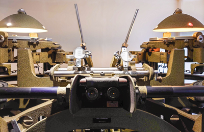
The creation of the map starts with photogrammetry, which is the process of extracting 3D information from photographs. We begin by doing a 'photo search' to see what aerial photos are available and when they were taken. On occasion it will be necessary to commission a certain area to be flown.
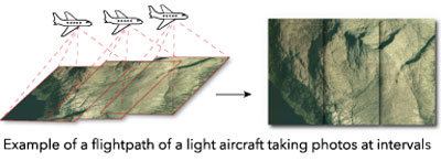
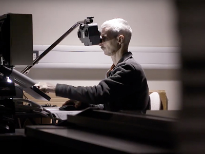
This allows the strip of photos to be georeferenced to the ground, and the overlap allows the land to be seen in 3D. Viewing through stereo eyepieces provides the operator with an elevated view of the terrain and a birds eye perspective.
Every detail is accurately recorded with painstaking care, selecting features that are useful to people navigating the terrain. The features that we want to appear on the map (tracks, buildings, woodland, marsh, stony ground, contours, etc) are recorded in separate layers. The accuracy of this data is approximately 5m in plan position and 1m in height. The hallmark of HARVEY mapping is its clarity and detail, and precisely plotted contours, supplemented by rock information.
Visit our Map Shop and Map Bothy and find out first-hand how we make maps.
Next up: How HARVEY Maps are made - Cartography & Survey
Return to the News & Features Blog


