June 2021 - Intermediate Navigation Skills - Compass Bearings
by Nigel Williams
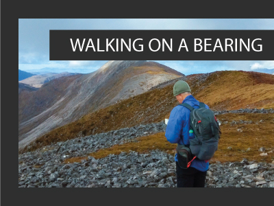
Compass Bearings
This is usually required when we move off the path to go across country, cutting a corner to another line feature or to a nearby viewpoint. First measure the distance to the destination, perhaps half a grid square (500m) so you have some idea of how long it might take. Carry out exactly the same process described above using the needle and base plate which is providing a straight line from your location to the destination. Looking down the baseplate can you see an obvious feature maybe 50 - 100m away, a tree, boulder vegetation change (never a cloud, sheep or people) that is exactly on or near where the compass is pointing? Now walk to it and repeat until you arrive at the destination.
The map and compass only need to be held in front of you when you are aiming. Once you have sight of an object you can relax. However, keep a good grip on the compass and map together so that the next aim doesn't require repositioning the compass. Having a rough idea of the time it should take is helpful. Add to that consideration of tick off features or recognising what you expect the contours to be doing etc. If one is looking for something that could be tricky to find, counting paces can be added to the process.
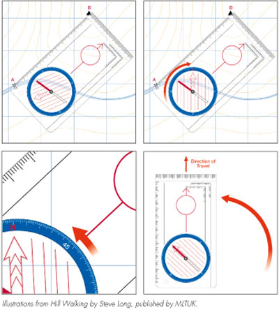
This quick or rough bearing is accurate enough for intermediate level navigation tasks using linear features with short simple cross country legs. It is the system that orienteers use and they are the best on-foot navigators. Even if you are leaving the top of a hill in the mist this is enough to get you heading down the right side of the hill. Practice this process in familiar terrain so you can use it confidently.
There is only one little step left for a full bearing which is explained in every navigation book and compass instruction. Turn the dial so N also points to the top of the map and the lines in the capsule align with the N S grid lines. The red end of the needle is then aligned to the N on the dial and the baseplate points in the direction of travel.
The actual bearing direction can be read off and communicated to others. It is a hang over from the military, but it can be a little more accurate over longer distances. As happy hill walkers we mostly simply say "it is that way" and we don't need the numbers. Keep it simple! The more bits to be lined up and moved around the more chance of making an error. There is an element of judgement around accuracy of alignments and aiming and most compasses are inaccurate up to 2.5º degrees, so our current magnetic variation is irrelevant probably for the next 20 years. Another advantage of the quick bearing is that it can be used with big gloves on or if your fingers are too cold to manipulate a fiddly dial. Some sticky rubberised map cases can also inhibit the dial turning.
Return to the Navigation Blog
 FREE UK delivery
 For Christmas delivery information

