 FREE UK tracked delivery
 Order by 12pm Mon-Fri for same day dispatch
Kilometres or Miles ...?
by Nigel Williams
Nigel Williams takes us through Britain's metrification system. Which do you prefer? Do you think we should remove the 'miles' from our road signage?
"The kilometre was invented by Napoleon and imposed upon the rest of Europe with fire and sword. We beat Napoleon, so we're not having any of that rubbish here."
"The Romans brought the concept of the mile to Britain, and we're not going to drop it just because they left 1500 years ago. It's too soon. We don't like sudden changes."
Those comments rather reflect the reality. Since 1864 there have been around 7 government recommendations, or Acts Of Parliament, for the UK to adopt the metric system. For example; in 1895 a Select Committee of the House of Commons recommended that the metric system should be authorised for all purposes, taught in elementary schools and become compulsory within two years. There was pressure from international traders and industry and from scientists, and an appreciation of the impact it would have on education, but nothing happened.
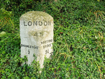
Metrification had massive implications for everything from construction to prescriptions, screw threads to paper sheet sizing, clothing sizes to our currency and the education system. It has happened slowly and mapping is a good example of that. Metric maps and a grid system were adopted by the military in 1919, slightly modified and formally adopted by OS as the British National Grid in the late 1930s following the decision to adopt metric measurements in 1936 when they initiated the re-triangulation of Britain. The first fully metric 1:10,000 and 1:25,000 appeared in 1969. It was then 1974 before we finally gave up the 1 inch to the mile maps for the 1:50,000. Even then we clung onto feet for measuring height for a few more years. OS had first proposed metric contours in 1943 but the government turned it down.
The French military originated the metre in the 1790s as one/ten-millionth of the distance from the equator to the north pole (approximately 10,000kms) along a meridian through Paris.
The definitive metre length was originally measured on an iron bar, now titanium and iridium, to avoid expansion and contraction with temperature. Methods of measuring the metre have been updated a number of times to be more accurate. Most recently (1984), the Geneva Conference on Weights and Measures has defined the meter as "the distance light travels, in a vacuum, in 1/299,792,458 seconds with time measured by a cesium-133 atomic clock which emits pulses of radiation at very rapid, regular interval". None of the definitions changed the length of the metre, but merely allowed it to be measured and duplicated more precisely.
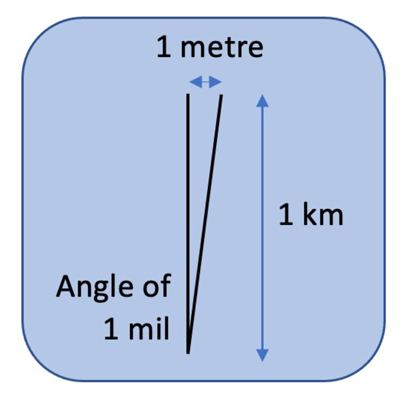
I regularly get people on navigation courses who turn up with a mils version of the Silva compass. The reality is that the average hill walking compass is inaccurate up to 2.5 degrees, more than 40 mils and more than the current magnetic variation, so it is all a bit of an irrelevance for recreational purposes. Numbers are just for communication. The process of doing a bearing off the map will still have the compass pointing them in the right direction regardless of numbers or colours or letters on the dial.
The cost and likely confusion of changing our road signage makes this final conversion to metric very unlikely, especially after leaving the EU so we can make our own rules.
Take a look at the range of fit for purpose navigation equipment and navigation books.
Return to the Navigation Blog


