FREE UK tracked delivery
 Order by 12pm Mon-Fri for same day dispatch
May 2021 - National Map Reading Week
by Nigel Williams
These skills are simple and don’t require numeracy. The skills required should match our walking experience. If that is achieved confidence levels will rise and perhaps more people will want to explore the countryside more often. Accept that everyone makes navigation errors but the skills improve with practice. Even if you are not responsible for navigating, have a map to hand and follow the progress identifying features and the distance covered.
Plan progressive walks
Build confidence with the map symbols and scale. Start by choosing routes that keep to large, simple handrail features e.g. tracks and paths. This will reduce the chance of navigation errors.
A second stage would be a mix of handrails and short cross country sections to another handrail (cutting corners) or big, obvious point feature (hill top). The third progression would be going cross country between smaller points features without handrails, probably requiring a good range of strategies and technical compass work and relocation skills.
Planning your route
Spend time studying the map and planning the route, to create a handrail to follow. Try to visualise the ground and know what to expect and see.
Timing a journey
Estimate the likely speed of travel over the day. Almost all walking maps are 1km across a grid square, 1.5km diagonally. We all walk at different speeds but estimating the day based on 3kph (20 minutes across a grid square) allows for regular stops. If walking uphill add a minute for each contour crossed going uphill. Treat downhill the same as being on the flat.
Setting up to navigate
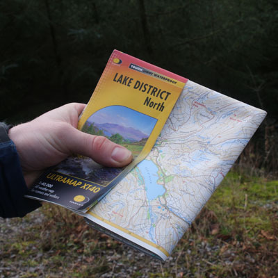
Have the map and compass readily available and easy to use, ideally waterproof and in a pocket. Fold the map to the area being walked (about A5 size) and have the compass available to be held on the map with one hand so the two items are used as one.
Map and compass hung around the neck compromise the core skill of map setting. Be able to hold them in a comfortable position for ease of reading and so that they can be held up near arms length at eye level to accurately align features on the ground with the map and vice versa.
Re-tie the loop of cord that often comes with the compass as a single cord with one end tied to the compass and tie a loop big enough to thread the compass through at the other end. Attach to a belt loop or pocket zip.
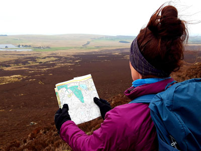
The single most important navigation skill is setting or orientating the map. Either by the features around you or by simply ensuring the red end of the compass needle points to the top of the map where the title is. The needle should be aligning accurately with the north south grid lines.
Observation
Look around and take in information. Think about the relationship between objects you see. This helps set the map and follow progress using tick off features.
Tick off features
Be curious to identify features on the map and on the ground whilst you are walking. Bends in the path, crossing streams, edge of woods, fence bends etc. Tick off features as you travel along the route.
Catching features
Recognise “Catching features” - identify things beyond the decision making points on your route. It is very easy if you don’t see what you expect, to keep on walking. A catching feature might be a stream crossing the path beyond the turning you should have taken. Using timing or pacing can also act as mental catching features.
Contours
Contours provide about a third of the map information available to the walker. They portray the shape of the terrain around you. Learn to include this third dimension when navigating.
GPS
As a back up to the map and compass, download a free app to your mobile phone that can give you a grid reference of your location (no signal required). It won’t drain the battery like digital mapping does and it is free. Also useful if you need help.
Practice for confidence
A wise navigator once said that "Navigation is 25% map work, 25% compass work and 50% confidence in the other two". The individual skills of navigation are easy and practice builds confidence.
Return to the Navigation Blog