 FREE UK tracked delivery
 Order by 12pm Mon-Fri for same day dispatch
Teaching Navigation - how the book came about
by Nigel Williams
In 1994, soon after leaving the military and qualified with all the UK Mountain Training awards, I thought I knew a thing or two about teaching navigation. How wrong I was. I attended an Orienteering instructor course run by two Scottish gurus of the sport; Tom Renfrew and Terry O'Brien. It was an absolute revelation and upturned all of my navigation teaching experience of the previous 20 years. I had dabbled in the sport, but never appreciated the structure and intricacies of it, as well as the fun and games that could be had in teaching and learning map and compass skills without the need for numbers.
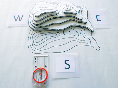
The potential benefits for other organisations engaged in more recreational navigation was immediately apparent. The sport has a really well-structured syllabus and teaching progressions, often supported by research from the worlds' leading orienteering nations.
The late Peter Palmer had already appreciated the overlap between orienteering and recreational navigation when he set up the National Navigation Award Scheme (NNAS) in 1994. He was a school teacher running DofE but also a very good orienteer and coach.
It became clear that the UK approach to teaching navigation is not based on any research and lacks a relevant structured approach appropriate for general outdoor recreational navigation; it is instead based on the needs of the military and Ordnance Survey dating back to the 1930s. The focus was on plotting grid references and measuring angles rather than making confident, on the ground decisions about which way to go. It is driven by map reading skills as opposed to matching navigation decision making skills to the terrain to be walked on and the outdoor experience of the individual learner. This is perpetuated through the teaching in geography lessons and exams. Interestingly there is no teacher training course within the education sector on teaching the subject.
What is concerning is that the motivation for many wanting to gain the adventure activity awards is so they can teach navigation skills to mainly school and youth groups but also novice adults.
There is often talk about Accredited Prior Learning (APL) in outdoor leadership and coaching but navigation seems to be overlooked in this respect. Interestingly, poor navigation is probably the leading cause across the main outdoor qualifications for candidates being deferred or failed. It seems surprising therefore that there is not a universal outdoor sector approach to teaching the subject and a focus on increasing the pass rate.
Since the first edition of Teaching Navigation was published in 2018, there has been a huge amount of research published into how humans navigate, cognitive navigation and our development of spatial awareness. Understanding how we develop our cognitive navigation processes helps underpin the teaching approach and should make us more aware of the what, why, where, when, how and even who we are teaching.
All the ideas in the book are aimed at non-competitive general recreation activities and have been tried and tested with a wide range of clients whether it is a one-day beginners hill skills course, a DofE group or a Mountain Leader training week. The book seems to have become popular with most of the UK youth training organisations and also underpins the NNAS 1 day Tutor course. What exercises we use to teach the skills and how we go about it depends on many factors on the day. The book offers a range of ideas to pick and choose from supported by some basic principles and skills progressions.
This updated 2nd edition, I hope will be more future proof. It appears to remain the only one of its genre outside of orienteering, and I am very grateful to HARVEY Maps for supporting it and in particular to the ever patient Chris, Production Manager at HARVEY Maps, for editing and amending the ideas and scribblings into a published document.
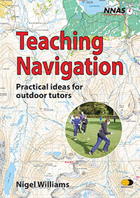
- You can take a closer look at the latest edition by following this link - Teaching Navigation
Return to the Navigation Blog


