 FREE UK tracked delivery
 Order by 12pm Mon-Fri for same day dispatch
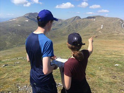
Teaching navigation - the influence of research
by Nigel Williams

Researchers use a range of spatial tests both practical and through survey questions such as the Santa Barbara Sense of Direction (SBSOD) test. They are investigating animal navigation, using MRI scans on human brains during navigational tasks with VR headsets, and eye tracking technology to understand navigation decision making. A citizen science computer game, Sea Hero Quest, ran for 4 years with 4.5 million downloads in 37 different countries producing vast amounts of data around cog nav.
Even with access to the research, we need a level of experience to interpretate the information and the opportunity and willingness to experiment with it.
The research subject areas that might influence our teaching are:
- How terrain influences navigation learning and wayfinding
- Observation and eye tracking influenced by our ambulatory confidence
- Developing navigational confidence
- Decision making including common heuristics
- Developing and measuring levels of spatial awareness - "route knowledge" to "survey knowledge".
- Age related development of spatial awareness and it's decline in our later years.
- The impact of early years upbringing, environment and freedom to explore on the development of cognitive navigation and spatial awareness.
- The potential lifelong impact of habitual use of GPS and digital mapping on the development of spatial awareness.
- Understanding human responses and strategies to being lost.
- The inability of humans to walk in a straight line without external references from landmarks or environmental cues (night time, whiteout, dense forest) etc.
- Research in coaching for marginal gains from the leading orienteering nations
- The different navigation strategy preferences between men and women
- The role of the hippocampus and neural connections with other parts of the brain.

There are a number of challenges: Access to the research is often pay walled or simply falls under the radar so it can take quite a bit of internet searching. Much of the research is based around the urban environment rather than the outdoors. Academia seems to have little idea that their work could influence the teaching of navigation skills, making it more efficient, effective and memorable and improve safety in the hills for instance. However, it is up to us to work out how to use the information.
Much of the research needs more time and a larger body of participants. Concern over the impact of habitual GPS phone navigation interfering with the development and maintenance of spatial awareness in young people began around 15 years ago, (ten years after it became available). Continued regular monitoring of the spatial awareness of some of the original research participants appears to indicate a correlation between the amount of use of a phone for navigation and the decline of spatial awareness.
Experimenting with approaches to teaching novices can be insightful, experimenting with new knowledge is fun for both learner and teacher, it makes us more perceptive of our client's challenges and needs. Reflecting on what did and didn't work informs our future teaching.
- If you are in need of a compass then we stock a great range of items and other useful navigation equipment, suitable for all levels of navigation.
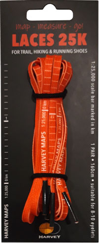
- For the perfect lanyard to go with your compass, the HARVEY Map - Measure - Go! scale bar laces double up to make measuring distance easy! Available in two scales, 1:25,000 scale markings (red) and 1:40,000 scale markings (yellow).
Return to the Navigation Blog


