 FREE UK tracked delivery
 Order by 12pm Mon-Fri for same day dispatch
Teaching the next generation to navigate
by Nigel Williams
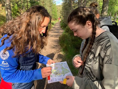
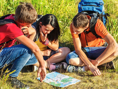
Navigation does not really require numeracy. It involves on the move deductions and decision making, have we passed the stream, do we go left or right at the junction? Getting to grips with the symbols and scale can be done on foot as a far more enjoyable and relevant, holistic, active teaching process. Increasingly I think there should also be an element of encouraging and teaching decision making. During a short walk, from time to time, simply ask the students to point to where the car park is. It is non-verbal and the tutor can check with map and compass and offer encouragement. That can progress to decisions at simple path junctions.
An appropriate teaching approach is probably a hybrid, integrating paper with all the tools available (compass, GPS etc) rather than suggesting an either or approach. Critical to this though is an integrated process of progressions across the skills, the terrain/environment and the tools, starting with a simple but detailed map and just a compass needle.
There is another element to consider, the life experiences of those we are teaching which impacts their "terrain confidence". There is good evidence that people brought up in urban areas are behind the cognitive navigation levels of those brought up in rural areas. Urban area travel is generally restricted to up or down a linear feature (roads and pavements) and decision making being left or right at a junction. Whereas those from rural communities are more likely to have experienced a freedom to travel and explore in multiple different directions, using a wide range of linear features (field boundaries, streams, woodlands etc) as well as having options to explore cross country in random directions. Evidence suggests that early opportunities to explore in the countryside has the greatest impact on our cognitive navigation development, and as boys are often more likely to be allowed to do this they may gain an early, but temporary advantage over girls.
Additionally, if someone has developed terrain confidence they will be less focused on where to place their feet to avoid tripping, and more able to look around and take in navigational information. Urban environments tend to have reliably smooth path ways, but the countryside doesn't, so urban dwellers will initially spend more time focusing on placing their feet, than on looking around and appreciating the navigation features.
The Ukraine war is highlighting the limitations and vulnerabilities of GPS signals, and therefore may cast doubt over the reliability of such devices in the future. There is a huge effort to develop other location devices, but they are some way off being affordable hand-held devices. These are reasons why we should perhaps maintain an emphasis on paper maps and traditional navigation methods.
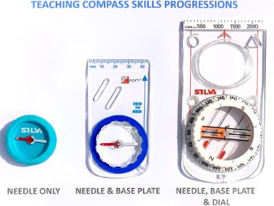
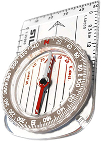
It is all about progressions, and not just in terrain and environment, mapping and skills, but also in the use of the tools. Using a progression of compasses is really helpful for the novice. They only need a magnetic needle with a red end for north for map setting. Later they can progress to a needle and base plate, and after that eventually to a needle base plate and dial with numbers on. Starting with that third level introduces too many options and irrelevant and confusing information.
Integrating the GPS/phone once the novice is using standard mapping can also be progressive. Introducing grid references (it tells you where you are at that moment rather than some random point on a map in a class room). Altitude can be introduced, and even bearings with phone compass in apps such OS Locate, the phone itself can be used like a conventional compass.
The ideal outcome is that young people see a paper map as a key functional and aesthetically attractive item of navigation equipment. At the same time appreciating that they can use their phone as a back up tool to help with their decision making, and as a compass, altimeter and location device when combined with the paper map.
- For more information on navigation, take a look at Nigel's blog from May 2021, an introduction to basic navigation strategies
- If you are in need of a compass then we stock a great range of items and other useful navigation equipment, suitable for all levels of navigation.
- For the perfect lanyard to go with your compass, the HARVEY Map - Measure - Go! scale bar laces double up to make measuring distance easy! Available in two scales, 1:25,000 scale markings (red) and 1:40,000 scale markings (yellow).
Return to the Navigation Blog


