FREE UK tracked delivery
 Order by 12pm Mon-Fri for same day dispatch
The Edge of the Map
As the John o' Groats Trail map is August's Map of the Month, we spoke to Trail Development Manager, Kenneth McElroy, about what makes this route on the edge of the map so special.
Go grab yourself a map. Any map. The older the better. Preferably a stained map, with blotches and the distinct possibility of sea monsters drawn upon them. Find a spot along the coast - now trace your finger along the map - where do you end up?
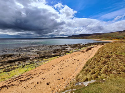
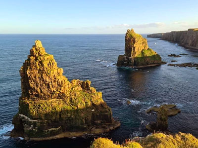
There is something enticing about the ends of the earth; the final points and destinations where the land meets the sea, where the horizon meets the sky. This is where the hospitable meets the unpassable, a line between the known and the unknown.
Now, this time, grab yourself a map of the British Isles. Place your finger on the map, and go north. No, I mean NORTH. And no, I don't mean Berwick-upon-Tweed, or Glasgow, or even Aberdeen. Trace your finger all along the eastern coast of Britain, until you come to Inverness. Some of you may think this is the ends of the earth - but this is where our tale, and our trail, begins.
Quiet country roads lead to steep-sided, wave-thrashed cliffs, where medieval castles and prehistoric brochs can be explored; where the clamour of seabirds gives way to tranquil environs of glades and forests. It is a fantastical land, and a magical journey, and one which truly opens up and immerses the visitor in the north of Scotland; a place which may seem like another world, an unknown land - terra incognita for some.
But, of course, with the onset of the North Coast 500, this part of the world is certainly no longer unknown; in fact, the North Highlands were never unknown, but they were perhaps afforded less attention than other parts of Scotland. Indeed, John Thurso, Chairman of Visit Scotland, once noted that "A particular bête noire of the Scottish Tourism Industry is to cut the map off at Inverness."
Travel and tourism, then, is under the spotlight. There are, however, ways to enjoy this green and pleasant land which don't break the bank, or put pressure on the environment, and herein lies just one of the many attractions of long-distance walking. Ditching the car and setting off on a long-distance walk may seem daunting, but with a good pair of hiking shoes, a map, and a little forward-planning, there is no finer, healthier or more sustainable method of experiencing an area.
The John o' Groats Trail, then, delivers slow, sustainable tourism which can nourish body, mind and soul; so, pack your bags, grab that map, and get yourself a good pair of hiking shoes, and set off north. Start your adventure at the edge of the map!
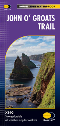
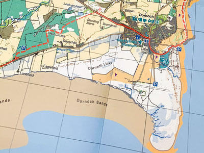
- If you are interested in exploring this route, take a look at the HARVEY John o' Groats Trail map. The route is marked clearly in red and it contains useful information to help you along your way.
Return to the News & Features Blog