Understanding map scale
by Nigel Williams
Knowing and understanding the concept of map scale is an important skill to have in navigation. Nigel Williams discusses the different map scales and breaks down large and small scale in a topic that is often taken for granted.

When we talk about large and small scale, the size of the second number of the ratio can be a bit confusing. The lower the second number, the greater the room for the cartographer to add lots of detail, but a standard map sheet will cover a smaller area. A higher number means the standard paper sheet will cover a greater area but with less detail.
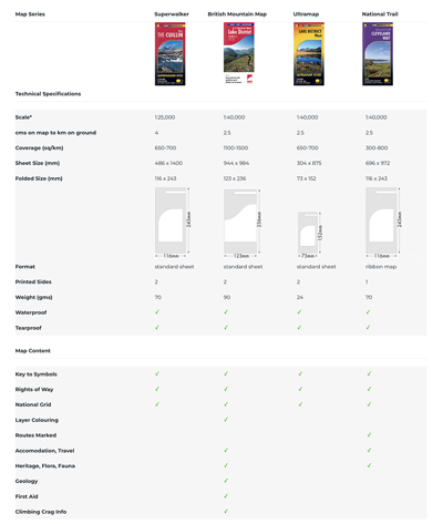
Large scale = low number, less area, lots of detail e.g. HARVEY Superwalker 1:25,000 scale.
Small scale = high number with small amount of detail e.g. HARVEY cycling maps 1:100,000 scale.
UK walking maps are generally 1:25,000, 1:40,000 or 1:50,000. The grid lines on these maps show squares that represent 1km on the ground regardless of the map scale. Across a square diagonally is approximately 1.5km.
The easiest metric map to use is the popular orienteering scale 1:10,000 map. 1 centimetre = 100 metres and 1 millimetre = 10 metres. Great for beginner navigators in woodland terrain to gain confidence and get a handle on the subject. But clearly that scale of map would be of little use for hill walking.
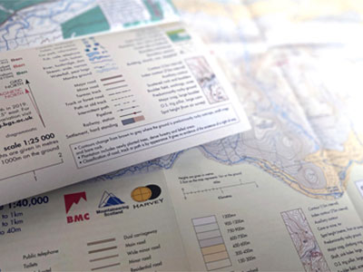
Map makers kindly help us appreciate the scale on the map cover. For a 1:25,000 scale map they put "4cms = 1km" and it will be 4cms across the grid square. From that, simple metric calculations are easy for more accurate short distance measurements i.e. 4mm = 100m and 1mm = 25m.

Knowing the distance enables us to calculate a time estimate to the next junction for instance, or possibly to pace if real accuracy is needed for a short distance.
If we walk at a 4kmph, a fairly normal average speed on a flat path, 100m takes approximately 1.5 minutes and 1km about 15 minutes. So knowing it is approximately 15 minutes across a square, half way across a square is about 7-8 minutes. We now have a distance and a way of measuring it on the ground. We can add a few minutes on to each kilometre if going uphill or the ground is rough. "Naismith's formula" suggests adding 1 minute for each contour line crossed going up, but treat going down the same as on the flat. It generally works for a 10m and a 15m contour interval.
A good compass with a long base plate will have various scales on it for more accurate measurements, and it is quick and easy to use. A set of distance scales is known as a "romer".
Romer scales separate to the compass are available, usually a credit card sized plastic card which could be attached to your compass string to keep it handy.
Alternatively, it can be put into a map case with the folded map. To use it inside the case, pick a piece of grass and align it along the path you want to measure from the tip of the grass to your thumb nail, and then put this along the romer to measure the distance.
Beginner's guide to Navigation - Basic Skills.
Return to the Navigation Blog
 FREE UK tracked delivery
 Order by 12pm Mon-Fri for same day dispatch


