 FREE UK tracked delivery
 Order by 12pm Mon-Fri for same day dispatch
Winter navigation strategies
by Nigel Williams
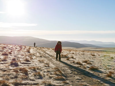
Keeping to paths in the summer requires simple navigation decisions. Often at a junction with predetermined direction choices needing just the compass needle to point to the north edge of the map in order to match it to the ground. Once chosen, the path guides our direction. If we become misplaced it is always wise to keep to the trail and back track rather than head across open ground to try to rectify an error.
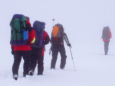
Leaving or losing the path increases the navigation skills and strategies required exponentially. It requires a multi-tasking effort, choosing and setting a bearing to walk on and accurately maintain that direction. Measuring the distance on ground, using strategies to find the destination and possibly deal with not initially finding it. This is a big step up in skills, strategies, and confidence. However, developing these skills when fundamentally most summer walking rarely involves leaving the path and having to practice these skills, adds to the challenges of winter. People get cold standing huddled around the map for long periods and it lowers morale. Navigation efficiency which can come from prior planning and skills practice has a significant impact on a winter's day.
Prior planning in winter is far more critical than a summer day. Avalanche and cornice hazards develop and change depending on the wind direction, precipitation, temperature changes and altitude. So too do some natural navigation clues which may have appeared several days earlier with a different wind direction from the day of the walk. Studying the avalanche and weather forecasts in the days before is really important, impacting route choice, navigation and safety on the day.
As paths and streams disappear winter navigation can quickly become 80% reliant on contours, along with strategies which are critical to decision making and hazard avoidance.
Skills such as using slope aspect (the direction a slope faces) and "boxing" doing 3 sides of a square or a dog leg using just pacing and bearings to avoid high risk areas - corniced cliff tops and avalanche hazards. Map and compass should be the prime means of navigation. A GPS can be a help if one can use it in the cold with big gloves and interpret map contour information in relation to the environment and hazards.
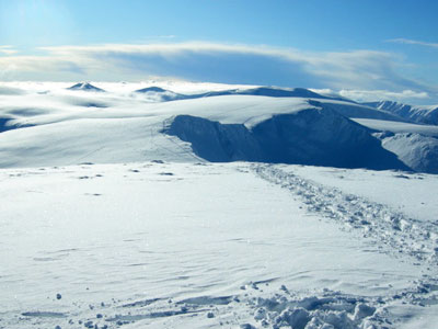
There are natural navigational clues from the wind direction and snow sculptures such as sastrugi ridges, and rime ice, that grow on boulders into the wind and help gauge our direction in relation to them, even if they were created with a prior wind direction.
Pacing and timing are affected in soft snow, often reducing us to 2kmph. When pacing on a flat, firm surface the distance between the heel of the front foot and toe of the rear foot on each step tends to be the length of our foot print. Soft snow enables us to see this and estimate how many paces we are doing for 100m. Walking heel to toe will double our usual 100m pacing. After about 700m, pacing can become inaccurate, so identifying subtle contour features helps us break down the route into shorter legs.
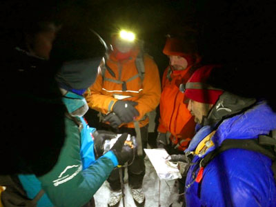
Cold hands and big gloves can make turning a compass dial really difficult and time consuming when speed might be a high priority to keep warm and make progress. The orienteers technique, just using the compass edge along the desired route on the map and turning them together until the north end of the needle points to the north edge of the map, works well. Keep everything aligned, aim ahead to follow the direction of travel arrow on the baseplate. With a little practice it is just as accurate as a normal bearing.
The winter environment impacts our equipment and clothing. Set yourself up to navigate, if it awkward to access and use the tools you need, they risk being ignored until it is too late. Day and night vision are essential to winter navigation and safety. Ski goggles are the single most important piece of kit, without them it can be virtually impossible to shield your eyes from driving snow crystals and navigate. Short days also require an effective head torch (rechargeable from a phone power bank is good).
Even if we are well organised and equipped, in a blizzard it is possible to become disoriented and lose confidence in one's ability to navigate. At night with snow blowing diagonally across our vision and the wind impacting the direction of travel, the conditions can become mentally overwhelming especially if there are also concerns about terrain hazards. If anxiety is allowed to take hold, it can override the cognitive functions needed to help us navigate and make sound decisions. A situation often made worse by any reduction in core body temperature and numb hands in big gloves.
Winter navigation is a significant step up in terms of navigation skills, strategies and confidence and all needed in an uncompromising but often beautiful environment.
- If you are in need of a compass then we stock a great range of items and other useful navigation equipment, suitable for all levels of navigation.
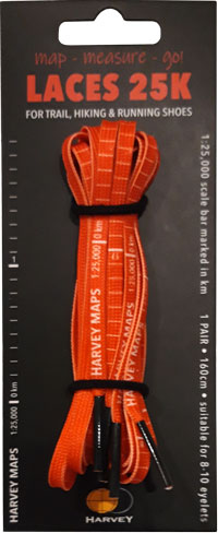
- For the perfect lanyard to go with your compass, the HARVEY Map - Measure - Go! scale bar laces double up to make measuring distance easy! Available in two scales, 1:25,000 scale markings (red) and 1:40,000 scale markings (yellow).
Return to the Navigation Blog


