FREE UK tracked delivery
 Order by 12pm Mon-Fri for same day dispatch
Is there still a place for a paper map in a digital world?
by Nigel Williams
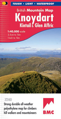
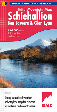
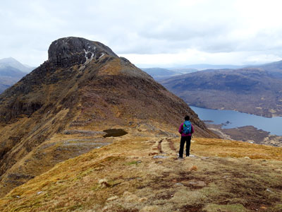
Paper maps have been around for quite a few centuries but their availability, accuracy and affordability for public recreation only goes back about one hundred years.
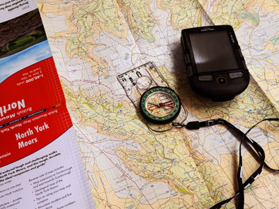
Digital map apps don't have to be used with a GPS; it is the habitual use of that combination that research is suggesting has a negative impact on developing spatial awareness, cognitive navigation and the hippocampus part of the brain.
Whilst it might appear that digital mapping is the way forward there are some issues to be overcome. Not just the usual battery life problems but also the practical issue of cost and teaching basic navigation skills.
Most young people learn some level of map and compass navigation skills at school or through a youth organisation. Many have mobile phones, but not with the digital mapping capabilities sufficient for outdoor activities and expeditions. Educational establishments can get a licence to print off A4 map sheets and hand them out to students year after year, which is not currently possible with digital map apps.
The phone can offer location information to use with the map for free and, rather than having a separate compass, I am increasingly coming across teenagers simply using the compass on their phone for paper map setting, which is fine for Bronze Duke of Edinburgh Award pupils following well marked tracks. Within map app "settings" you can choose to have the map automatically set as you turn the phone or you set it yourself using landmarks or a compass needle. However, due to the powerful magnet in the speaker of the phone, you need to be very confident and flexible with your compass skills to avoid deviating the needle.
I don't think we are anywhere near a point in time where a DofE teacher, for instance, would decide not to teach map and compass basics and be happy to send a group out with just a digital device with a programmed route to follow. If it failed, and that resulted in a rescue scenario, I think there would be serious questions asked. Map and compass skills are deeply rooted in the syllabus of youth groups' outdoor skills training.
One of the advantages of digital maps is the ability to expand them and instantly flick to different scales for more detail. But the screen size limits one seeing the bigger picture of the surrounding landscape, and route planning is difficult compared to when using paper maps.
Robustness of phones can be overcome with shockproof and waterproof cases. Battery life is still an issue but perhaps that will change soon. However, most people are now carrying power banks. Cold weather drains the batteries very quickly. The phone needs to be waterproof, but the screens do not respond to finger movements when wet or wearing gloves or mitts. Bright sunshine makes the screens unreadable and certainly difficult to share with other members of a group. Compass polarity reversal has also become an issue if the phone and compass end up in the same pocket for a while.
There remain significant and increasing vulnerabilities with GPS. A number of alternatives that can get around jamming and spoofing are being developed, but mainly for military purposes. Until the weaknesses can be reliably overcome, technology should probably remain a back up to paper.
Map making will still continue and we will still need the high quality maps we have today. There is already a perception that using digital maps with the GPS is a lot easier, as you don't have to learn any navigation skills such as aiming off, attack points, relocation skills etc to be able to use it. However, the ability to navigate using the traditional map and compass method will ensure safety in the most challenging of navigational situations, where digital methods may be unpredictable.
We have passed the time when the only choice was a paper map. As technology improves perhaps the teaching of navigation and map reading will adapt also - just follow the arrow on the screen. Perhaps our cognitive navigation functions will eventually become redundant and irrelevant to human existence.
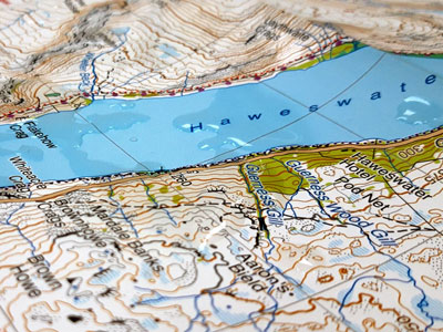
This is something digital mapping fails to do; there is not the emotional attachment one gets from unfolding a much-used grubby map and remembering the landscape, the people and the adventures we shared.
Find out more ...
- Why choose a HARVEY map? Click to find out what makes our maps special
- HARVEY 1:25,000 and 1:40,000 scale digital mapping is available on Outdooractive - get 10 Euro off your first year subscription
Return to the Navigation Blog